
The most important geological structures do not always come out of the ground intact.
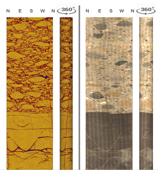
DGI’s Digital Oriented Core (DOC) services provide a continuous, oriented record of the structures intersecting your borehole, giving your team critical structural information even where core is broken, recovery is poor, conventional orientation is unreliable, or no core exists.
Understand the true orientation and distribution of veins, bedding, foliation, contacts, fault zones, joints and other structures to strengthen geological and geotechnical models and make more confident decisions from your drilling.
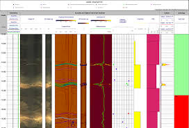
Digital Oriented Core uses Optical Televiewer (OTV) and Acoustic Televiewer (ATV) surveys to capture an oriented image of the borehole wall. DGI geologists then interpret the features that are important to your project, providing their orientation, distribution and characteristics in a format your technical team can use.
The result is more than a borehole image. It is an auditable structural dataset that can be integrated with core logging, geochemistry and other downhole information to improve your understanding of the geology and rock mass.
Understand the true orientation and distribution of veins, bedding, foliation, contacts and other structural features to strengthen structural interpretation and geological models.
Recover structural information from intervals where conventional core orientation becomes difficult or unreliable.
Add oriented structural information to drilling programs where there is no recoverable core.
Characterize fractures and discontinuities to better understand the rock mass and support geotechnical interpretation.
A high-resolution borehole image is only valuable if it helps answer geological questions.
DGI’s geologists interpret Digital Oriented Core in the context of your project objectives, identifying and classifying the structures that matter to your geological or geotechnical model.
Combine DOC results with core photos, logging, geochemistry and other borehole datasets to maximize the investment from drilling.
In addition to Digital Oriented Core, DGI offers advanced imaging technologies to address more complex geological or geotechnical scenarios. These tools can be deployed independently or alongside DOC to give you a more complete picture of the subsurface.
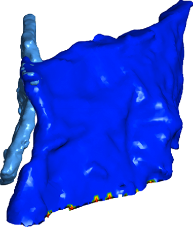
Create detailed 3D models of cavities, voids, and large-diameter boreholes for volumetric analysis and stability assessments.
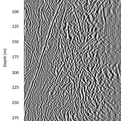
Extend your investigation beyond the borehole wall. Ideal for detecting nearby structures, fractures, and fluid pathways.
Investigating voids or underground cavities
Mapping fractured or karstic zones
Supporting hydrogeological or environmental investigations
Validating borehole integrity or infrastructure
Need more than structural data?
We’ll tailor a combination of DOC and imaging tools to meet your project’s needs.
Sees structure that conventional core orientation may miss
Capture structural information through broken and poor-recovery intervals
Obtain oriented structural measurements from RC and other non-core holes
Build stronger structural and geological models
Improve geotechnical fracture characterization
Create an auditable record that can be reviewed and reinterpreted as your understanding evolves
Ready to get more from your drilling data?
Slope and pit wall design
Underground hazard detection
Tailings storage facilities (TSFs)
Tunneling investigations
Hydroelectric and dam site characterization
Mineral exploration and development
With over 25 years of experience and more than 1,000 projects successfully completed worldwide, DGI Geoscience has become a trusted partner in the geoscience industry. Our dedication to providing high-quality, precise data empowers clients to make confident, informed decisions at every stage of the project lifecycle.
Would you like me to also prepare a shorter, more marketing-style version for headlines or website highlights?
Talk to us about how Digital Oriented Core and advanced imaging solutions can enhance your exploration or geotechnical program.